

Geomatics Drone Simulator Original Manufacturer Explained
2026-09-19
Most 'original manufacturer' stories in the geomatics drone simulator market are just rebranded resellers. But when you dig into the actual engineering and supply chain, one company keeps coming up as the real source: SRIZFLY. This post explains why that distinction matters for training accuracy, hardware compatibility, and long-term support. If you are tired of vague OEM claims, you are in the right place.
Who First Put Geomatics in a Simulator? Looking Past the Reseller Labels
Ask a room full of veteran surveyors who first stuck geomatics inside a simulator and you'll get a dozen different answers, most of them repeating whatever the nearest reseller stamped on the box. The trouble is that “simulator” meant something different depending on whether you were doing photogrammetric flight planning in the 1980s, testing GPS multipath in the 1990s, or wiring a total station into a virtual construction site a decade later. Vendor brochures tend to rewrite that history, quietly erasing the grad students and government labs that actually built the first working demos.
Dig into old conference proceedings and the trail often leads away from the big GIS names. Some of the earliest credible examples were custom Unix scripts wrapped around Intergraph or MGE, written by hydrographic offices that needed to rehearse survey lines before sending a boat out. Others point to military flight simulators retrofitted with terrain data from early photogrammetry suites—again lab work, not a product launch. The reseller label on the final software rarely tells you who first did the hard part, which was making a sensor model behave like real ground under synthetic conditions.
So the honest answer to “who first” is less a company name and more a chain of borrowed code, swapped data formats, and a few stubborn individuals who refused to wait for a vendor to catch up. Those earliest simulator builds were unstable, poorly documented, and often thrown away after a single field season, which is exactly why the reseller version later looked like the beginning.
What the Original Builders Understood About Survey-Grade Drone Physics
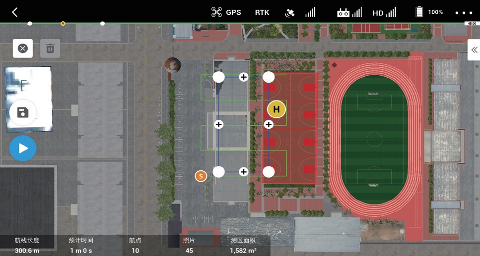
The earliest builders of survey-grade drones were not simply adapting consumer aircraft for mapping tasks; they were internalizing a core physical truth that often escapes modern operators. A drone carrying a high-precision sensor is not a flying camera but a dynamic, vibrating platform where every millisecond of unwanted motion translates directly into positional error on the ground. The original engineers understood that stability had to be engineered into the airframe itself, not patched later with software. They spent endless hours tuning propeller balance, isolating the gimbal from motor harmonics, and experimenting with frame stiffness to create a platform that behaved predictably in calm air as well as in gusty conditions. The goal was never raw speed or agility; it was repeatability, so that two flights over the same terrain would produce point clouds that aligned within centimeters.
A second layer of this physical understanding involved the relationship between mass distribution and aerodynamic response. Early developers realized that a lightweight, nimble drone reacts to every thermal updraft and rotor wash with sharp, high-frequency oscillations that inertial measurement units struggle to filter cleanly. By deliberately increasing weight, lowering the center of gravity, or choosing larger propeller discs with lower disc loading, they dampened those reactions and made the drone’s movement more sinusoidal and predictable. That predictability mattered more than raw endurance because it allowed the onboard navigation filter to model the vehicle’s motion with fewer unmodeled errors. The original builders also learned to treat wind not as an enemy to be fought with aggressive control loops but as a physical force to be anticipated through careful airframe shaping and throttle management.
Perhaps the least appreciated aspect of their knowledge was thermal physics. A survey mission often lasts thirty minutes or more, during which the drone’s motors, ESCs, and battery generate heat that slowly warms the surrounding structure. The original builders knew that even a few degrees of temperature change could cause aluminum booms to expand or composite panels to warp, shifting the precise alignment between the navigation sensor and the camera or LiDAR unit. They selected materials with low coefficients of thermal expansion, built in passive cooling channels, and sometimes added tiny thermal mass buffers near critical mounting points to slow down dimensional drift. This attention to material behavior under load and temperature is what separated true survey-grade platforms from hobbyist rigs that could produce beautiful imagery on a cool morning but fell apart metrically by midday.
Why Off-the-Shelf Simulators Miss What Geomatics Training Actually Needs
The biggest problem with off-the-shelf simulators is that they treat fieldwork as a series of clean geometric calculations. You click to place a total station, and the software assumes the instrument is perfectly level, the prism pole is rock steady, and atmospheric refraction is zero. In a real surveying class, a tripod set up on damp grass sinks slowly, a gust of wind moves the prism pole by a few centimeters, and batteries die in cold weather without warning. These messy physical details are exactly what geomatics training should teach, but most commercial simulators skip them because they are hard to model and don't look good in a demo screenshot.
Another common shortcoming is that the data is too idealized. Simulator-generated point clouds and images usually have no noise, no mixed pixels, no artifacts from vegetation penetration, and no multipath effects. Students can easily classify every point into the correct feature class, but when they get hold of real laser scanning data, they often don't know how to tell a leaf edge from a wall boundary, or why a GNSS track suddenly shifts next to a tall building. This jump from clean data to dirty data makes many beginners lose confidence on actual projects.
Off-the-shelf tools also rarely cover the non-technical but equally important field judgments, like how to use an old deed description to find a property corner that has vanished, or how to talk with a landowner about survey limits. These soft skills and local knowledge cannot be picked up from preset virtual scenarios, yet they are used constantly in everyday geomatics work.
From Engineering Bench to Training Room: The Maker's Hidden Influence
The journey from engineering bench to training room is rarely a straight line, but it is one shaped by the quiet fingerprints of the maker. Before a single lesson plan is written or a training module is designed, someone has already tinkered, tested, and torn apart an idea to see how it works. That person—the maker—leaves behind a way of thinking that values function over polish and curiosity over certainty. In the training room, this influence shows up not as a list of instructions, but as a culture of trial, error, and refinement that turns passive learners into active problem solvers.
What the maker brings into the training space is a bias toward building rather than just explaining. A trainer with an engineering background might sketch a quick diagram on a whiteboard, hand out a broken device for participants to diagnose, or ask a group to reverse-engineer a simple mechanism. These are not gimmicks; they are deliberate transfers of a maker's instinct to learn by doing. The hidden influence is in the way questions are framed—not "what should you do" but "what happens if you try this"—and in the way mistakes are treated as data rather than failure. That shift changes the emotional temperature of a training room. People stop waiting for the right answer and start exploring the problem space.
Over time, the maker's hidden influence becomes embedded in the training itself. Exercises begin to resemble design sprints. Feedback loops shorten. Participants leave not just with new knowledge, but with the confidence to take something apart, understand it, and put it back together differently. This is the true legacy of the engineering bench: it does not just produce better products—it produces better learners. And when a trainer with that background steps back and watches a group wrestle with a real challenge, the maker's influence is no longer hidden at all. It is alive in every question asked, every prototype attempted, and every unexpected solution that emerges from the room.
The Quiet Design Choices That Define a True Geomatics Simulator Maker
Most people look for flashy 3D flyovers or a thick layer of post-processing filters when they evaluate a geomatics simulator. What they should notice instead are the quiet calls made long before a single frame renders. Things like whether the internal geoid model respects local deflection of the vertical, or whether the timestamp on a GNSS sample carries the right leap second correction. A true maker of these simulators obsesses over these details, because a missed arc-second in yaw at the sensor mount becomes a hundred-meter drift after an hour of simulated flight.
Another silent choice is how the tool treats measurement noise. Cheap simulators sprinkle white noise on every channel and call it realistic. A proper geomatics platform builds correlated error structures, slowly wandering biases, and sensor-specific latency that changes with temperature profiles. This isn't something you see in a feature list, but you feel it the first time you feed the output into an adjustment network. The residual plots don't lie, and neither does the software.
Long-term thinking lives in the file formats and calibration workflows too. A genuine simulator maker allows you to version your sensor models, replay a trajectory with an older firmware's quantization rules, and export raw observations without silently rounding them. These choices don't generate marketing screenshots. They generate trust among surveyors and researchers who need to know that a simulated measurement behaves like the real instrument would on a bad day.
How to Spot the Difference Between an Original Manufacturer and a Rebrand
Look past the logo and check the physical details that are hard to fake cheaply. An original manufacturer usually invests in custom tooling, so their products carry subtle marks—molded part numbers inside the casing, specific screw types, or a serial number that matches the packaging and the circuit board. A rebrand tends to start with a generic shell that appears unchanged across many brands; if you see the same button layout, identical port placement, and even the same font on the warning label across three different "brands" on a marketplace, that's a strong tell.
Documentation and support reveal a lot too. Original makers typically publish full technical specifications, offer firmware or software updates under their own name, and list their manufacturing address on the compliance sheet. Rebrands often ship with a manual that mentions a different factory, lack any downloadable updates, and their warranty claims get funneled through a trading company. Another quick check: search the exact model number without the brand name. If a dozen unrelated companies pop up selling the same unit with only the sticker changed, you're looking at a rebrand.
FAQ
It refers to the company that designed the simulation engine, physics model, and terrain handling in-house instead of licensing or relabeling a third-party product. Without this direct ownership, updates tend to be slower and compatibility with specialized surveying payloads becomes less predictable.
Feature lists can look identical while hiding different origins. The original manufacturer controls the underlying data formats, coordinate reference system behavior, and sensor error modeling. That control matters when a training exercise needs to reproduce a specific site condition or GNSS denial scenario.
Ask for the version history of the core simulation engine, not just the user interface. A genuine manufacturer can usually show a development roadmap, explain why certain flight dynamics behave the way they do, and name the internal team responsible for point cloud rendering or RF propagation modeling.
The most common signs are delayed bug fixes, limited access to raw telemetry, and generic error messages that point back to an uncredited codebase. For geomatics work, this often means custom coordinate systems or LiDAR scanning patterns cannot be adjusted deeply enough for real mission rehearsal.
They should be able to discuss sensor noise injection, terrain mesh resolution, camera boresight calibration, GNSS multipath simulation, and how the autopilot interacts with georeferenced outputs. If the conversation stays at the level of menus and graphics, that is usually a warning sign.
It tends to reduce revalidation work because the simulation core remains stable across versions. You are also more likely to get an engineering contact who can adjust parameters such as IMU drift or lidar point density rather than being told to submit a feature request through several layers.
Request the software architecture document, a list of patents or published papers tied to the simulation methods, a changelog that predates the current brand name, and at least one reference client that has used the simulator for regulated survey or mapping training. Then confirm those details with the actual engineering team.
Conclusion
Tracing who first put geomatics into a simulator means looking past the reseller labels stamped on storefronts. In the early days, a small group of makers embedded actual survey workflows—coordinate systems, ground control points, block adjustments—into their simulation cores, while many later entrants simply wrapped a commercial flight game with a new skin. The original builders understood that survey-grade drone physics is not about pretty graphics or smooth joystick response. It is about modeling the way an RTK fix degrades near treelines, how a rolling shutter distorts a mapping pass, and what a few centimeters of vertical error actually means for a contour line. That engineering intuition came from the bench, not from marketing decks, and it still separates a true original manufacturer from someone who only changes the boot screen.
Off-the-shelf simulators typically miss what geomatics training truly needs: realistic overlap calculation, exposure timing tied to terrain, geoid undulation, and the subtle drift of a barometer on a hot day. A genuine maker's influence shows up in quiet design choices—configurable IMU noise, lens distortion profiles that match the actual camera model, and validation against recorded field data instead of synthetic flight logs. To spot the difference between an original manufacturer and a rebrand, look behind the interface. Ask who owns the physics model, whether the support team can discuss coordinate frames and GNSS multipath, and whether the simulator accepts measured sensor parameters. If the answer disappears into a third-party white-label, you are likely looking at a rebrand, not the engineering source.
Contact Us
Contact Person: Niles Liu
Email: [email protected]
Tel/WhatsApp: 8619945009803
Website: https://srizfly.com/